Image Map
Showing posts with label social studies. Show all posts

Mayflower Diagrams

Friday, March 25, 2016


We recently started reading about early English colonies like Roanoke, Jamestown, and Plymouth. Colonists had to have amazing constitutions to survive life in the new settlements, but what has been more amazing to my students (and me) is the trip from England to the new world on the ship.

We did a little extra digging into the voyages on ships like the Mayflower. The Mayflower was a merchant ship and not really intended for voyagers. The 102 passengers mainly stayed in the gun deck or "tween" deck in a space that was about 80' long, 24' wide, and a ceiling height of about 5 1/2'. To give you a little comparison, a school bus is usually 40' long, so the Mayflower is the length of two school buses parked one in front of the other.
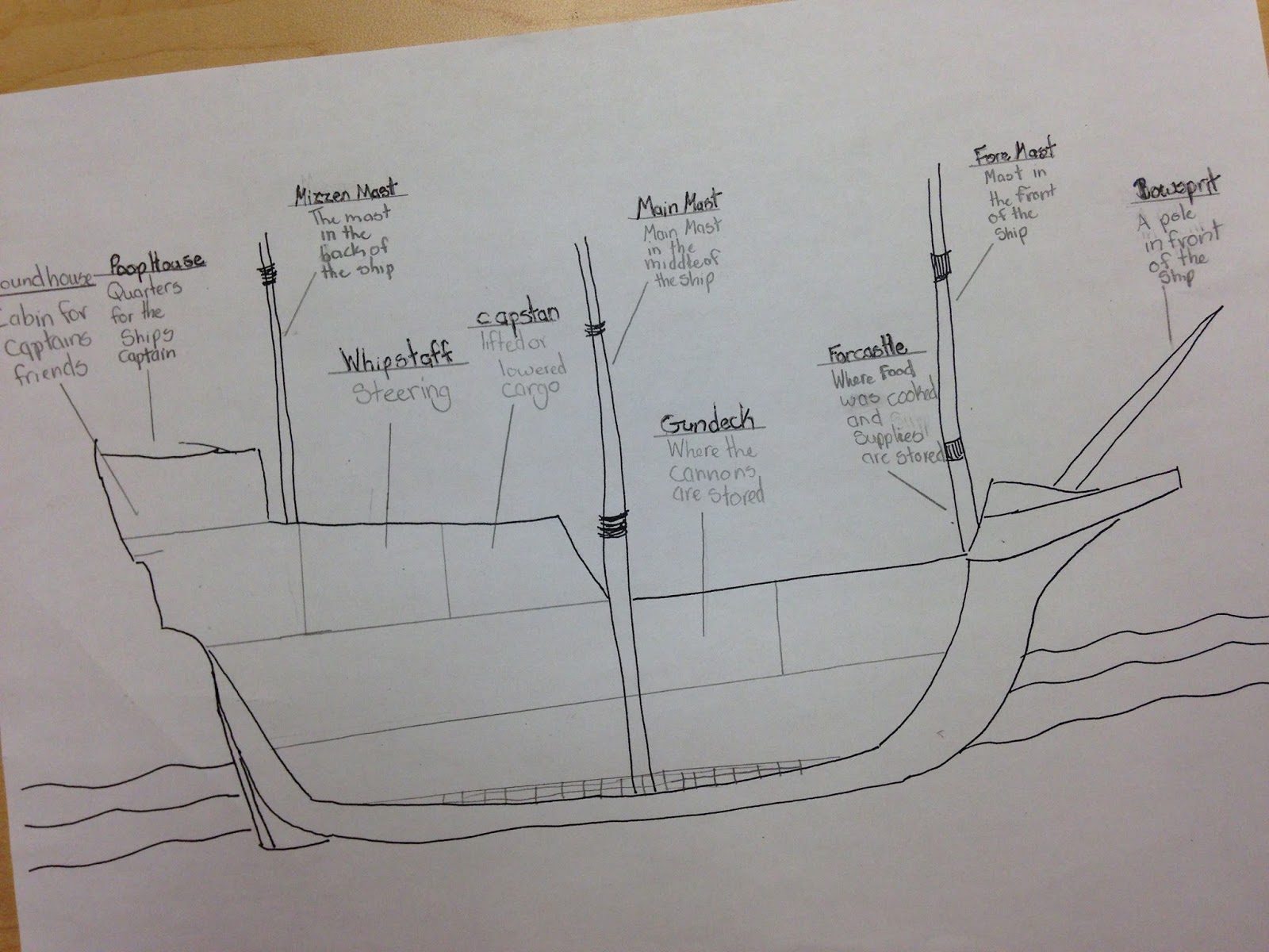

In order to visualize the parts of the ship a little better, the students are creating cutaway Mayflower diagrams with 14 main ship parts labeled. We defined the ship parts first and then searched Mayflower diagrams and pictures to draw our own cross-sections of the ship.


I found this SITE and this SITE with reliable definitions for the students, but there were plenty of other online resources. Google images had great results too. I gave the students this Mayflower Ship Parts Handout, and they completed the definitions first. After we compared definitions, students used legal sized white paper (and rulers) to draw, label, and color their diagrams. We did not quite finish before spring break, but I love the way the diagrams look so far. This has been a great activity to enhance my history content as well as work with proportion and measurement.

Caitlin
The-Room-Mom.com
https://www.teacherspayteachers.com/Store/Theroommom

Revolutionary Thinking Maps: The Declaration of Independence

Thursday, July 10, 2014

I'm super excited to start the first of a series of posts on how I use Thinking Maps (graphic organizers) in my classroom to teach about the American Revolution.  5 things you should know about Thinking Maps--


1.  They provide students with a way to visualize and make sense of new content.
2.  If you teach them early in the year, students begin to use them independently.
3.  They are great for interactive notebooks.  Seriously great.
4.  You don't have to make copies to use them.  Pencil, paper, done.
5.  You can use them with all content.  Check out my Thinking Maps board on Pinterest for some ideas.  

Let's start with the Brace Map.  Brace Maps show part to whole relationships.  When teaching the Declaration of Independence, I love to have my 5th graders start with the primary source.  The actual document.  It's quite overwhelming at first glance.  Fancy language and unfamiliar words abound!  So, I start by drawing the skeleton of the map, showing students that we can look at the Declaration of Independence in four parts.  Then, we are able to read through and stop, summarize, and connect to what we've learned about the events leading to the American Revolution.  Check it out, below! 


Come back soon for more on using Thinking Maps to teach about the American Revolution.

--The Pensive Sloth
Blog
Facebook
Pinterest